Signal Peak
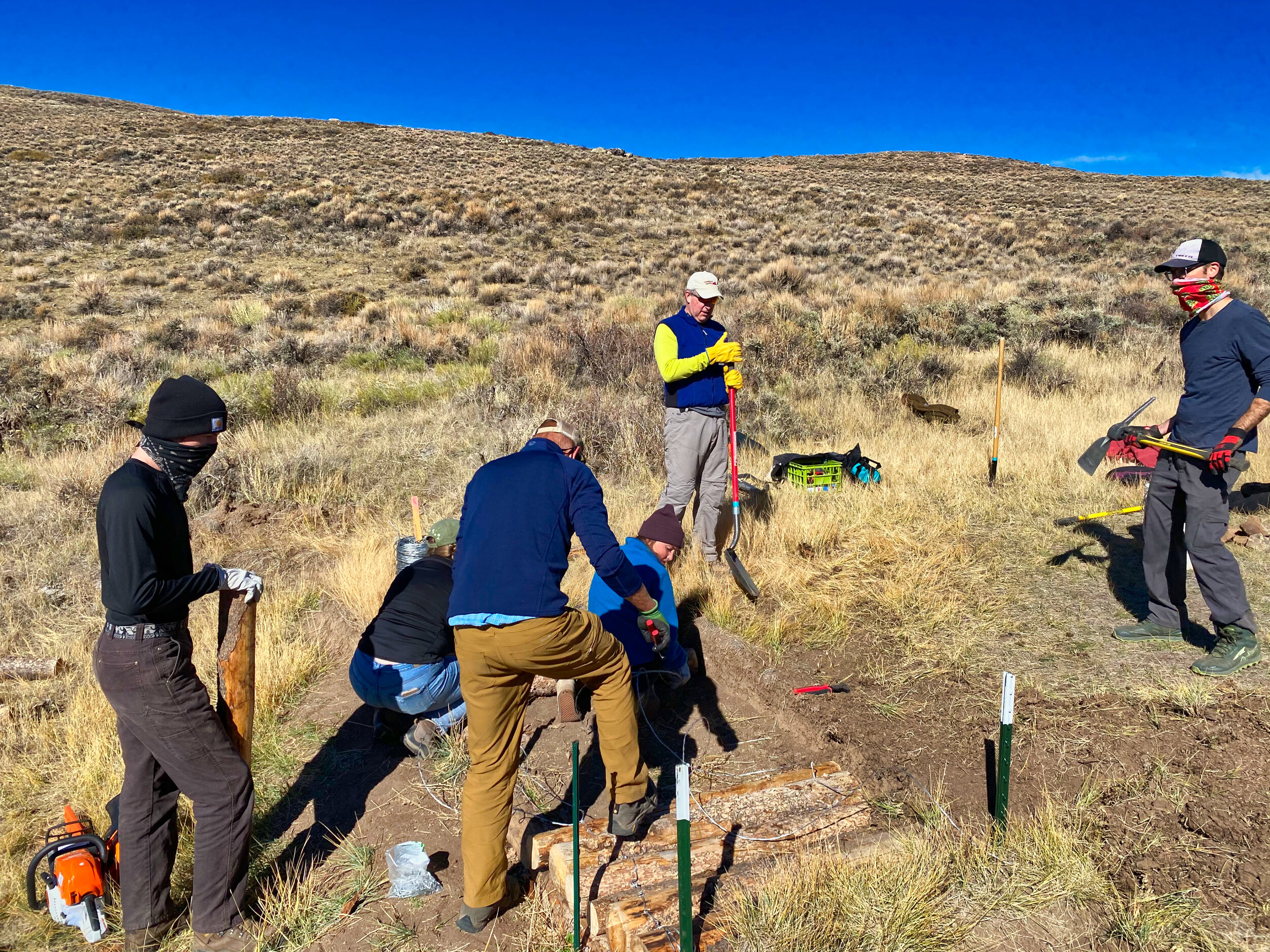
On October 17, 2020, HCCA, the BLM Gunnison Field Office, and the Upper Gunnison River Watershed Conservancy District completed a mesic meadow restoration project within the Signal Peak Travel Management Planning Area as a National Public Lands Day Volunteer Event. These partners represent a component of the Gunnison Climate Working Group, a collaborative partnership working to restore mesic meadows, utilized as brood-rearing habitat for Gunnison sage-grouse, a Threatened species under the Federal Endangered Species Act.
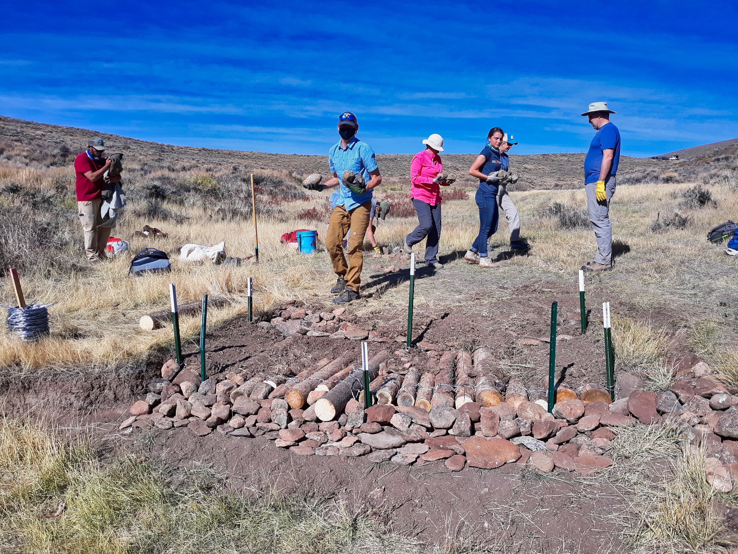
Twenty volunteers constructed 13 structures to preserve and enhance three acres of mesic meadow. This area has been impacted by a user-created trail called Chicken Scratch that BLM closed as part of the Signal Peak Travel Management Plan. As part of the decision, BLM agreed to stabilize and restore the area, which also allows livestock grazing. Usually, the project imports granitic rock for its rock structures but due to poor access to the site, volunteers gathered rock from adjacent hillslopes to construct 10 rock structures used to spread water into meadow surface; dissipate runoff energies; prevent accelerated erosion; and to trap fine grained sediment for vegetation to take root. Rock structures included rock baffles, one rock dams, and rock mulch run downs.
In addition, volunteers constructed two hand-built contour swales, which spread water across the landscape that had been captured by the closed user created trail. Contour swales were designed with a laser level to be set on the contour at a depth of six inches with a longitudinal length of five feet. Volunteers placed excavated soil from the contour swales in the old, closed route, converting concentrated runoff to sheet flow. In addition, we completed a log structure used to arrest an 18-inch headcut that threatened three acres of meadow. In all, this project is a success as incremental improvements to mesic meadow habitat is critical to the survival of Gunnison Sage-grouse.